

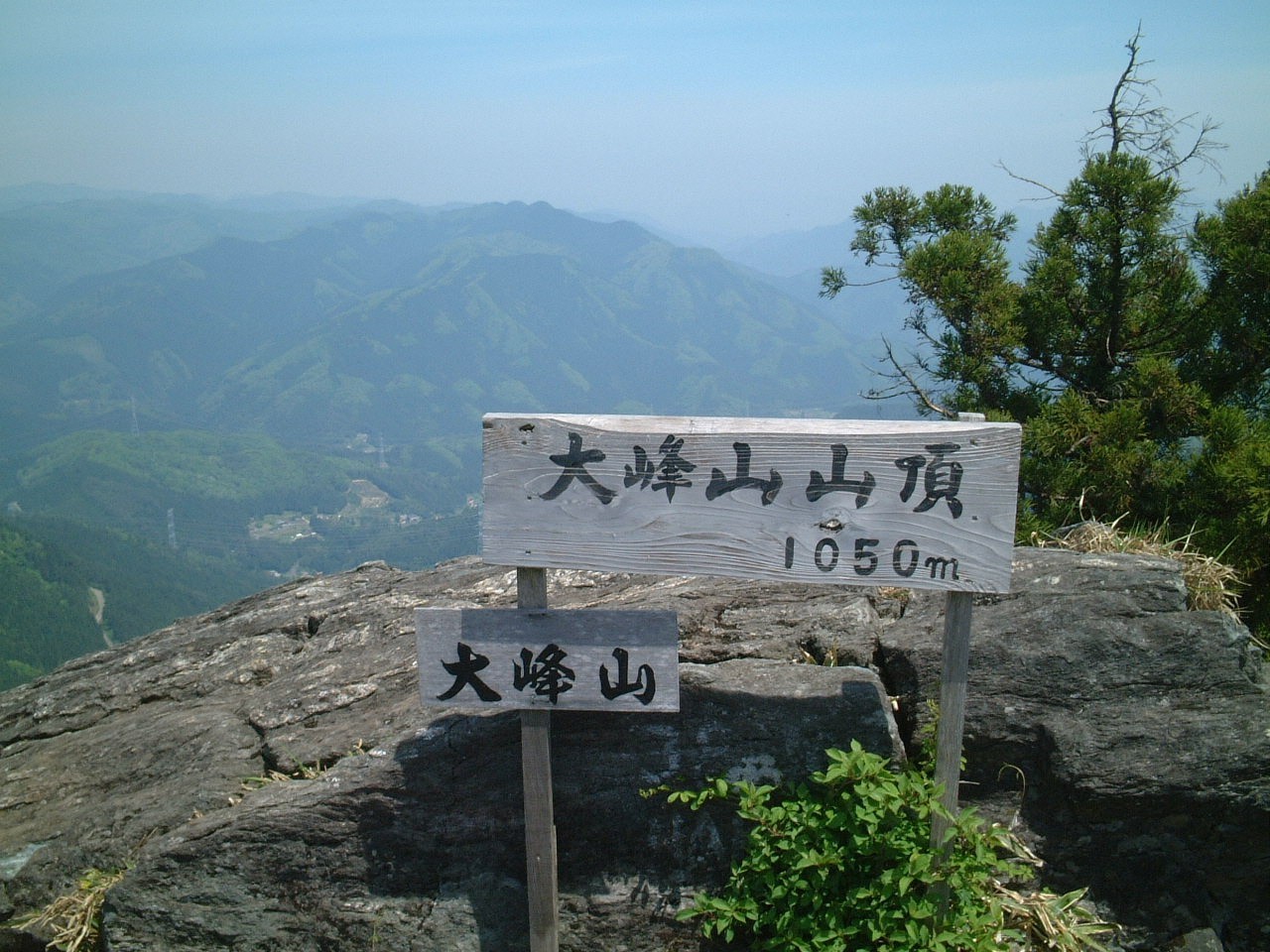
The summit, 1050m above sea level, is formed by a group of giant rocks, and in addition to the scenic beauty of the "Mawari-en", you can enjoy the view of Hiroshima Bay and the mountains of Shikoku. In the past, people walked from the direction of Hiroshima City, but nowadays, you can reach the summit in about 20 minutes by driving north on Prefectural Route 4 from Kushima/Hiraya and starting from the pass at the administrative border between Hatsukaichi City and Yuki Town, and you can easily enjoy the spring water "Chomei-sui" at 1000m. The most common climbing route is from the Kawakamiguchi trail, and it takes about 90 minutes from the parking lot to the summit. Most of the way to the summit is through the forest, which blocks out the strong sunlight and makes climbing comfortable even in summer. The trail is well maintained by local people.
INFORMATION
- address
- 〒738-0205Kujima, Hatsukaichi
- Phone Number
- 0829-31-56560829721115
- Website
- Number of parking spaces
- 30
- Parking notes
- 30 units